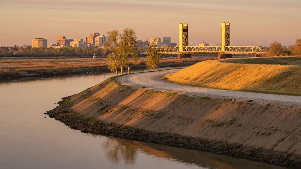
She was standing in a Natomas living room, listing sheet in hand, when she asked the question I hear every month: "They certified these levees, right? So why do I still need flood insurance?" Fair question. The answer is a map problem, not a water problem. The levees around Natomas were certified in 2023, but the flood map that sets your insurance requirement has not caught up, and until it does, the lender writes a check for a policy you never see. Here is the plain version of how that works, what it costs, and the questions to ask before you offer.
Two Maps, One House
Every house in this region answers to two maps, and they do not agree. The first is the flood insurance rate map, drawn by FEMA. It is the map the lenders use, and it decides whether you must buy flood insurance. The second is the levee certification, drawn by the Army Corps of Engineers. It is the map that says how well the dirt actually holds.
Natomas is where the two maps split. In 2008, FEMA de-accredited the Natomas levee system, pulled the basin out of the protected column, and remapped big parts of it into Zone AE. That zone means a 1 percent annual chance of flooding, which is the federal line that triggers mandatory insurance, and it came with a building moratorium that froze the area for years.
Then the money went in. The Sacramento Area Flood Control Agency ran a multi-billion-dollar levee upgrade through the basin. In 2023, the Army Corps certified the rebuilt levees as providing 1 percent annual chance protection, the classic 100-year standard, and work toward the 200-year level finished in 2025. The dirt is in better shape than it has been in decades.
But the map did not move. FEMA has not finalized the remap for Natomas, so the official flood insurance rate map still shows Zone AE today, in 2026. Reclamation District 1000, the local flood authority, says it plainly: until FEMA finishes the remap, a buyer with a federally backed mortgage still has to carry flood insurance. The levee is certified. The paper is not. That gap is the whole story.
What the Map Costs a Buyer
Here is how the requirement lands on a purchase. If your loan is backed by the federal government, which covers FHA, VA, USDA, and the conventional loans Fannie Mae and Freddie Mac buy, and the house sits in a Special Flood Hazard Area, flood insurance is not optional. The lender requires it, escrow collects it, and you find out the number somewhere between the offer and the closing table. Pay cash or use a portfolio lender and the requirement disappears, though dropping the coverage is a bet I would not take.
The dollar numbers are smaller than the fire story I wrote about last week, but they are not nothing. Published comparisons put the typical flood policy in Sacramento around $550 a year, and the Natomas quotes I see mostly land between $400 and $800 a year for a single-family policy. Some local sources figure the flood designation adds $1,200 to $3,000 a year in total carrying cost once you count the policy and the district fees, and about one in twelve households in Sacramento County carries flood insurance. The map touches a lot more addresses than Natomas.
There is a second line on the tax bill that surprises people. Reclamation District 1000 charges a benefit assessment for the levee work, and for a typical single-family lot it is about $10 a year, down from a $25 minimum in 2023. It shows up on the county property tax bill as a line called RD 1000. Ten dollars is not the story. The story is that the district is funded and the levees are maintained, which is exactly what the insurance company is pricing.
The Pocket and Greenhaven Difference
This is the part where buyers think they have me. If Natomas sits behind a certified levee and still pays, what about the Pocket and Greenhaven, the river neighborhoods on the other side of downtown?
They sit in a different zone. The Pocket and Greenhaven are mapped mostly in Zone X, the moderate-risk band, because they sit behind the accredited Sacramento River East Levee. Zone X does not trigger the insurance requirement, so a federally backed mortgage does not force the policy there. That is the good news.
The honest part: the requirement is not the same as the risk. Flood insurance is still the only coverage that pays when a levee fails or a storm drain backs up, and a homeowners policy excludes water coming up from the ground. The state's own levee flood protection maps show what a failure scenario would look like, and published estimates put Pocket-area flood policies around $1,500 to $3,500 a year under the newer pricing rules. A few parcels right along the river edge sit in Zone AE and carry the requirement like Natomas does.
So the rule of thumb: the Pocket is not required to insure, and it is still a good idea to insure. Those are different sentences, and buyers mix them up all the time.
Five Questions Before You Offer
You know what you know, you know what you don't know, and you don't know what you don't know. The flood zone is the third bucket. It is one line on a map, it decides a monthly number, and nobody mentions it in the listing. Run these five before you write an offer.
01
What zone is this exact parcel?
Not the neighborhood, the parcel. FEMA's map service center takes the address, and two streets apart can be two zones.
02
What kind of loan are you using?
FHA, VA, USDA, or a Fannie and Freddie conventional loan in a flood zone makes the policy mandatory, not a choice.
03
Is there a district line on the tax bill?
RD 1000 in Natomas, and other reclamation districts along the rivers. The assessor's record shows it before you ever close.
04
What does the quote actually cover?
The standard federal policy caps at $250,000 for the structure and $100,000 for contents. A house worth more needs a private policy or an extra layer.
05
When does the map change?
FEMA's Natomas remap is not final. When it lands, the requirement could lift and premiums could drop. Nobody can schedule that, so plan on today's map.
Or just bring me the address.
I have sold on both sides of this map for 37 years. I will pull the zone, run the numbers, and tell you what the water costs before you fall for the house.
Let's Check the Map Before You Make the Offer
Flood insurance is a Sacramento zip code question, and the answer shows up on the tax bill and the closing statement. I have sold in Natomas, the Pocket, Greenhaven, and up and down the American River from Gold River to East Sacramento, and I will pull the zone for the address you are looking at and give you the straight number. Thirty minutes on the phone and you will know exactly what the water costs.
Talk to you soon.